South Coast Crawl
Warilla, Bombo, Berry, Jervis Bay, Depot Beach, Bateman's Bay, Nelligen & Berrima
9-12th January, 2006
Return to
Aussie
Travel Page
 
Text and photographs © David Powell, except where indicated.
No reproduction (apart from personal use) without permission!
 
Return to
Home
Page

The latest travel photoreport (is that a legit word?). Four days travelling down the NSW south coast to Bateman's Bay stopping at Shellharbour, Berry, the Jervis Bay region, Depot Beach and Mogo. All trips have a return and the return trip took in Nelligen, Ulladulla and Berrima. All very scenic locations, even a bit of history here and there.
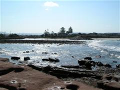
entrance to Little lake, Warilla
Little Lake entrance, Warilla
Image © David Powell, 2007

Tuesday
Headed off Tuesday morning. First stop was 90 minutes down the coast to drop in and spend a day with my folks at their holiday weekender at Warilla, a stone's throw north of Shellharbour. Did a few odd jobs about the place including a computer repair while Cynthia took off to the local swimming pool with my mum for a few hours. Reunited, we went for a walk for an hour or two along the coast to Barrack Point, midway 'tween Warilla and Shellharbour. First along a stretch of beach where there were
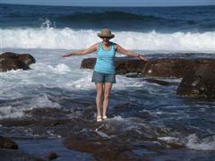
Cynthia on the Rocks
Barrack Point
Image © David Powell, 2007
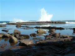
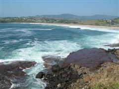
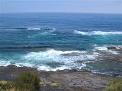
only a handful of swimmers and those in a sheltered spot - the water was very unseasonably cold and all the patrolled beaches in the region had been closed because of a series of rips. Then onto the rock shelf surrounding Barrack Point itself. The tide was starting to come in, so we didn't dawdle along that stretch too much. Even tho' the cliff was fairly steep and high, there were a few rough trails in a few places,should an emergency arise (which it didn't, I hasten to add!). Anyway, since the tide was coming in, the surf was pretty impressive. Some local surfers were out there enjoying the waves - rather brave (or foolhardy) since there was no beach and the surf was crashing onto rocks (in surfer circles it's known as 'The Madmans'). But safety and surfing don't seem to be two words that really go together. A few of the locals were doing their best to prove it - there was a flat-topped chunk of rock about 50 metres long and 1 metre high, a mini-mesa, if you like. The surf was breaking on the ocean side and particularly big waves washed over the top creating a waterfall on the inland side. The locals were crouching down behind the inland side as the water poured over. The cliff-face was interestingly carved by both wind and wave. Walked back along the top of the cliff. Before we'd gotten all the way back, the tide had covered most of the rock shelf and the mesa that'd provided the locals with lots of fun had become an island surrounded by angry waters.

Cynthia on the Rocks
Barrack Point
ocean waterfall
Cynthia on the Rocks, Barrack Point
Image © David Powell, 2007
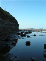
Tranquility & violence, Barrack Point
Image © David Powell, 2007
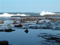
Waiting for the waterfall, Barrack Point
Image © David Powell, 2007

Off to a local club for dinner with my folks and a friend of the family I'd not seen in, hmmm, almost 20 years. Tho' at the time she had a different husband. Well that's the way it goes I guess. A few rounds of cards with my folks and then to the resort we'd booked in for the night. The world is full of coincidences - we ended up with the same room we got the last time we stayed there, a few months ago. Yeah, I know, all motel rooms tend to look the same, but they do have numbers.

Wednesday
Bombo Beach & Kiama
Bombo Beach & Kiama
Image © David Powell, 2007
Bombo Head
Bombo Headland
Image © David Powell, 2007
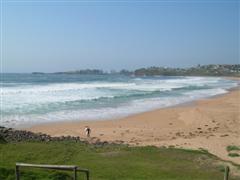
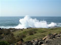
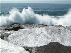
Back on the road again and on south. First stop was Bombo. One of the south coast's surfing meccas and the surf was definitely up. Walked around Bombo Headland and admired the views. Thanks to blue-metal quarrying in the 1880's the headland is a Moonscape of basalt walls and columns. Well it would be a Moonscape if it wasn't for the surf. Not much of that on the Moon. The northern side of the headland is known as the Boneyard. It all looks suitably rugged and dramatic. Apparently the headland has been used quite a lot for TV shows and movies. Even 30 or more metres up the cliff there was lots of sea spray. Just in from the coast it was evidently quarried, but given the roughness of the sea, I daresay the features right on the coast are natural. Lots of columns and stacks, to use the technical geological term for the formations.

Bombo headland
Surf, Bombo Headland
bombo beach & headland
40+ metre sea spray, Bombo
Image © David Powell, 2007
Surf, Bombo Headland
Image © David Powell, 2007
Bombo Beach from Headland
Image © David Powell, 2007
Crooked River Winery
Crooked River
Image © David Powell, 2007

Next stop was Crooked Creek Winery. On an earlier visit to the region we'd had some of their wine at a restaurant. Being suitably impressed, we made a point of finding the winery and buying a box of bottles. Not cheap, but their range is most palatable (not that I'm a wine expert). There're on the Pacific Highway, just inland from Gerringong. Only been in the business since 2001, it's already the region's largest winery and has won a swag of medals from regional to national. There's a restaurant and in February/March they even allow visitors to help stomp their grapes, the old fashioned way. If you're partial to a drop or two of quality vino, do drop in!
Old Court House, Berry
Image © David Powell, 2007

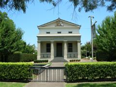
The road south then winds through gently rolling hills before reaching the town of Berry, about 10km inland. A little town, best known for its boutique shopping. Even the St Vincent's store is a boutique! Visited a few shops, spent a small fortune and had lunch at a café on the main street. Haven't seen the old courthouse before and since we had some time, stopped to have a look at that. Built around 1891, along the 'traditional' rural courthouses of the time, it continued in use until 1988. It has been restored and formal gardens (complete with fountains and ponds) established in the grounds. It's now used for weddings, exhibitions, concerts and the like. Inspired by the drought no doubt, one of the formal gardens has been redesigned for minimal water usage.

Late afternoon we arrived at Vincentia, on the shores of scenic Jervis Bay, there to spent the rest of the day and the night at friend's weekender. The rest of the day was fairly quiet .. chatting, playing cards and so forth. Been there several times before. A lovely atmosphere - it backs onto the bush, which was quite green, despite the drought, but then, it is only a block away from the coast. Lots of birds - a non-stop chorus, fortunately not too loud.

Thursday
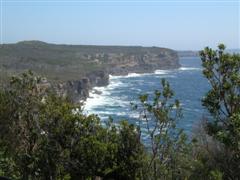
Cape St George
View south to Moes Rock,
from near Cape St George Lighthouse

Image © David Powell, 2007
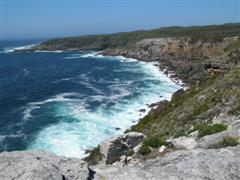
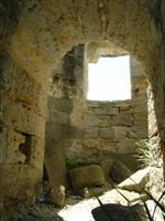
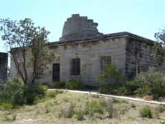
Said our farewells to our hosts for the evening. First stop for the day was the abandoned Cape St George Lighthouse and the surrounding Booderee National Park. The park also surrounds the Jervis Bay naval base and is a little enclave of federal land. There's also a naval airbase .. strange, I thought the navy was s'posed to focus on nautical means of transportation. The lighthouse was built in the 1860 using local sandstone (plenty in the area!). It's in ruins now. There're spectacular and rugged coastal views - no wonder they needed the lighthouse. To the south is Wreck Bay. Obvious why they called it that! Sadly, during the 1800's, Wreck bay was one of the most deadly and notorious stretches of the NSW coast. Not sure how many years the lighthouse has left - it's a lot more ruined than the photo in the local tourist brochure. Hopefully they'll stabilise it a bit more soon.
Lighthouse
Interior, Cape St George
Lighthouse

Image © David Powell, 2007

In addition to the main building there were also the remains of the stables, kitchens and the toilets. Strangely enough, the last were the best well preserved of all the ruins on the site, even tho' they were perched rather close to the cliff edge. Fortunately there's a stone fence along the cliff edge in the vicinity of the lighthouse, otherwise going for a midnight nature call might pose a few dangers, especially if one'd been celebrating beforehand! Walked around some of the trails to get some great views. No fences, rails or any other safety feature to be seen, apart from a fence around the ruins itself (and that's probably more to keep people off the ruins). So definitely a case of watching one's step - carefully! Especially with the stiff winds! An amusing side note .. the middle of nowhere and I had to queue up for the toilet!

The lighthouse has had a rather interesting history. Its location was chosen by a bureaucrat-cum-architect based not on where it should have gone by maritime needs but rather where it was easier to build - the light wasn't even visible from the northern approach (from Sydney) to the bay and during it's operation around 23 ships were lost in the area. The old story - common sense versus economics, with the former loosing out. It operated for 28 years before a replacement was built on the north head of the bay, a location much preferred by the real experts - those whose livelihoods were based at sea. Even after it was abandoned, the lighthouse continued to be a navigational hazard, especially on moonlit nights when the stone of the tower would shine, so around 1920 the tower was demolished with explosives. Time and the elements have sadly continued that process. There were also more than a few deaths on the site while the lighthouse operated, some from disease, others from falls over the cliff.
Lighthouse
lighthouse
toilets & moes rock
Lighthouse, east view
Image © David Powell, 2007
Lighthouse, south-west view
Image © David Powell, 2007
Old toilet block & Moes Rock
Image © David Powell, 2007

Moes Rock over ruins
lighthouse
cynthia
View south over ruins (Moes Rock)
Image © David Powell, 2007
Snapper Point & Governor Head
Image © David Powell, 2007
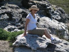
Cynthia, below lighthouse
Image © David Powell, 2007

Lunch was at the service station at Wandandian. The bacon and egg burgers were positively delicious!

Point Upright
Point Upright, from Depot Beach
Image © David Powell, 2007
Just north of Bateman's Bay, we took a detour to the coast to see Depot Beach - a friend of
Depot Beach
Depot Beach
Image © David Powell, 2007
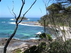
Cynthia's has a cottage there which is let out for holidayers and I daresay one day we'll stay there. The hamlet's on a bit of a cliff and below is a secluded beach. Pretty isolated and ideal for fishing and beaching. The water is brilliantly coloured with greens and blues. The hamlet is just a bunch of cottages, a public phone and a ranger's base - the area is surrounded by the Murramarang National Park. Quite pleasant on the beach and at the edge of the cliff (tho' calling it a cliff in most spots is something of an exaggeration), but a dozen metres further inland away from the sea breeze and the heat of the summer sun really bit. Even tho' it's not far from Bateman's Bay, Depot Beach is surrounded by national park and is very much an unspoilt beauty (and there's no mobile phone reception!). Magnificent views, nature right at your doorstep, virtually untouched by civilisation yet not really all that far away from it. Quiet and peaceful. And did I mention, no mobile phones? 'Cell phones' for those from the America's.

Mogo
Mogo
Image © David Powell, 2007
bateman's bay harbour
Bateman's Bay Harbour
Image © David Powell, 2007
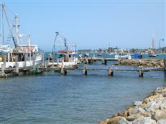
Back on the road and south to Bateman's Bay where we checked into the motel we'd booked for the evening. It was still early and plenty of hours of daylight left, so time for some more sightseeing. First stop was Mogo, an old gold mining town 10 minutes or so south of 'The Bay'. Like many other old villages that had lost their function, this one's been resurrected by the art and craft crowd with over 45 shops. The main street's full of shops selling all sorts of boutique stuff such as jewellery, artwork, clothes, antiques and the like. It'd just turned 5pm, so most of the shops were closed - in the country very little stays open after 5pm. Had a look at the few shops that were open. There's even an 1850's gold mining theme park and a zoo there for the kiddies.

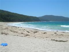
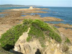
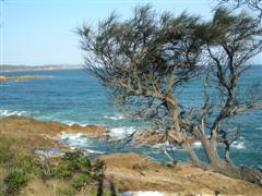
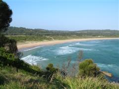
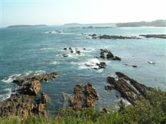
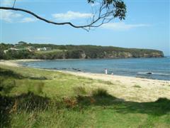
Headed east from Mogo to Broulee, on the coast. From there we spent nearly two hours travelling up the coast to Bateman's Bay (normally a 10-15 minute drive), stopping at all the possible lookouts and scenic views on the coast t'ween Broulee and Bateman's Bay. And there're quite a few of them! Broulee Beach was long, at least a km. Not really a surf haven - to the south it's protected by Broulee Island and to the north by Mossy Point. But great for paddling or just boosting the vitamin D levels. High vegetation covered dunes hide all sign of civilisation from the beach. The southern tip of the beach is especially well protected which lead to Broulee being established as a port as early as 1830's, tho' by 1850 it had been eclipsed and little, if any, evidence remains on the ground of that history today. Today it's a holiday haven. To the north of Broulee Beach is Mossy Point, the next stop. Lots of rocks just offshore. At low tide you can walk out on a rock shelf to a small island at the tip of the point. Some quite remarkable rock formations, weathered by wind and surf over the millennia. A few rocky coves on the southern side of the point, quite unsheltered from the southerly winds, as well as some neat trails thru' the thick but stunted pine trees covering the southern side of the point. Walking the narrow trails, with the sound of the wind blowing thru' the trees it was kinda magical. Almost as if you were in some fantasy world. And then there're the views! Melville Point is not all that spectacular in itself, but it offers wonderful views north along Barlings Beach and Long Nose Point (honest!) and south of Mossy Point and Broulee beyond. In spring it offers great views of migrating whales.
Broulee Beach
cynthia, broulee beach
mossy point
View south along Broulee Beach
Image © David Powell, 2007
Cynthia, Broulee Beach
Image © David Powell, 2007
Mossy Point
Image © David Powell, 2007

mossy point
mossy point
mossy point
Rocks, Mossy Point
Image © David Powell, 2007
Rocks, Mossy Point
Image © David Powell, 2007
View from Mossy Point
Image © David Powell, 2007

barlings beach from melville point
Tomakin Cove, from Melville Point
Barlings Beach, from Melville Point
Image © David Powell, 2007
Tomakin Cove, from Melville Point
Image © David Powell, 2007
Tomakin Cove, from Melville Point
Image © David Powell, 2007

Burrawarra Point is just barely visible from Broulee and Mossy Point. A hour hike from the car park will take you to the lookout at the tip of the point. We forwent that and checked out the views near the car park of Guerilla Bay, Jimmies Island and Rosedale, to the north. Didn't see
south from rosedale point
View south, from Rosedale Point
Image © David Powell, 2007
burrawarra point
Guerilla Bay, from Burrawarra Point
Image © David Powell, 2007
Osama tho'. The peninsula at South Rosedale, according to the map, was mostly parkland and should offer great views. Alas all bar the narrowest part of the peninsula was filled with homes. A pity. Still, managed to get some views from the neck of the peninsula where it was too narrow for houses. To the south was a little secluded beach and views of Burrawarra Point and to the north was Rosedale Beach.

Continuing north we stopped at Malua Bay and its famous beach (yup, there were surfers there and the surf was up). Apart from the beach, Malua Bay's also popular amongst divers. Then Lilli Pilli Point, overlooking Lilli Pilli Beach. Yup, yet another beach. It's said that NSW has more beaches on its coastline than anywhere else in the world. Big ones, secluded ones, tiny ones, surf ones. A beach for everyone.
rosedale beach
Malua Bay
lilli pilli beach
Rosedale Beach, from Rosedale Point
Image © David Powell, 2007
Malua Bay Beach
Image © David Powell, 2007
Lilli Pilli Beach
Image © David Powell, 2007

With daylight running out, the last stop on the coast crawl was Observation Point at Batehaven. Strangely, the car park is all fenced in and you have a bit of a walk to go around the fences to get to the original trail system that takes you around the point. Almost as if they don't want people going there. But the views are spectacular. North into Bateman's Bay and south along rugged coastline down to at least Lilli Pilli. East are a group of islands just offshore, one big enuf to have its own forest and a large cave just above sea level. That's Snapper Island.
Snapper Island, Observation Point
Observation Point, Batehaven
Caseys Beach, Observation Point
Snapper Island, Observation Point
Image © David Powell, 2007
Observation Point, Batehaven
Image © David Powell, 2007
Caseys Beach, Observation Point
Image © David Powell, 2007

Finally back to Bateman's Bay and dinner. Lots of seafood cafés and fast food joints in the town. Quite a few pizza shops. But if you're after something other than seafood and pizzas, but not a restaurant, your choices are very limited.

Friday
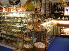
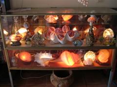
We were going to go on a river cruise up the Clyde River to Nelligen, but the timing just didn't work out. So plan B instead. First stop was "Treasures from the Deep", an opal and shell museum-shop. It wasn't big, but it was packed to the rafters with shells, exoskeletons and preserved marine specimens. Probably millions of the things. As well as shells there were also a small collection of crystals and mineral specimens. As for the opals, the owner is a retired opal miner from Lightning Ridge, so he definitely knows his opals. We browsed thru' the opal collection looking for something to match an opal ring Cynthia already had. It was an expensive ring, so it turned out to be an expensive necklace - which had an opal the guy had mined himself. Got a few mineral specimens for myself.
Shell & Opal Museum, Bateman's Bay
bateman's Bay from Holmes Lookout
Shell & Opal Museum, Bateman's Bay
Image © David Powell, 2007
Shell & Opal Museum, Bateman's Bay
Image © David Powell, 2007
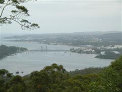
Bateman's Bay from Holmes Lookout
Image © David Powell, 2007

Then it was the long trip back home to Sydney. Just north of Bateman's Bay we stopped off at Holmes Lookout. Reminded me of the Sherlock Holmes joke about the missing tent. Eventually we found the lookout, after driving several kilometres past, and then only because someone else had found it. A nice view of Bateman's Bay and the Clyde River, tho' partially obscured by the trees. Presumably when the
riverside park, Nelligen
Riverside park, Nelligen
Image © David Powell, 2007
lookout was established the surrounding trees were a lot smaller and less dense.

Further on to Nelligen. An old town founded in 1854 on the banks of the Clyde River, upstream from Bateman's Bay. First a timber town, then gold was found in the region and the town had a second life. But when that ran out, the town slowly died away. Before its last gasp, it had a third life, this time based on tourism. The area is a haven for river fishing and boating - a wide and deep river - deep enuf that back in its heyday steamships travelled upriver to the town. There's not much left now. Between bushfires and the ravages of time, only a few of the old buildings remain. Today the town consists of a few homes, several cafes, two churches (one abandoned) and a big caravan park. Peaceful, quiet and great views. The best views we found were uphill from the site of the old school (burnt down now). From the empty block (now a park) you got a great view upstream. The little park by the river was positively delightful. St Joseph's (1896), Mechanics Institute (1903), The Steampacket Inn (1905) and the Post Office (1900) - the latter two are now B&B's. There's also the old court house (1893), now the local Anglican church.
Steampacket Hotel (1905), Nelligen
Courthouse Church, Nelligen
Clyde River from old school site, Nelligen
Steampacket Hotel, Nelligen
Image © David Powell, 2007
Courthouse Church, Nelligen
Image © David Powell, 2007
Clyde River from school site, Nelligen
Image © David Powell, 2007

View from Warden Head
View from Warden Head, Ulladulla
Image © David Powell, 2007
Trail, Warden Head
Trail, Warden Head
Image © David Powell, 2007
The last time we would see the coast was at Ulladulla. After that the road heads inland. We took the opportunity for another detour. Ulladulla dates back to 1838 with the first white settler in the area. By the 1840's the town was a going concern. Today it's home to the largest fishing fleet on the South Coast and a popular tourist destination. Had a look at the view from Warden Head, just to the south of Ulladulla. Lots of nasty looking rocks just offshore, so no surprise there's a lighthouse there. Built in 1873, the lighthouse was moved to its present location in 1879. Unlike the other lighthouse we saw at Jervis Bay which was built from sandstone, this one was made from wrought iron, one of only two in the state - the builder happened to own an iron foundry. Then around to the other side of Ulladulla Harbour where Cynthia spent 3/4's an hour catching some vitamin D on a beach on Ulladulla Head. I took the opportunity to take some photo's of the harbour and finish off a book.
02 View from Warden Head
Ulladulla Harbour from Ulladulla Head
Beach & Ulladulla Head
View from Warden Head, Ulladulla
Image © David Powell, 2007
Ulladulla Harbour from Ulladulla Head
Image © David Powell, 2007
Beach & Ulladulla Head
Image © David Powell, 2007

Heading north again we reached Nowra. Instead of continuing along the highway through Wollongong and onto Sydney, we took the longer, scenic route via Kangaroo Valley. In Kangaroo Valley we saw the first real signs of the drought - it was a lot dryer than normal. Usually it's quite lush in the valley. Having been there several times recently, we didn't stop but continued onto Moss Vale. Lots of history and heritage there, but that'll be another trip. On we continued to Berrima.

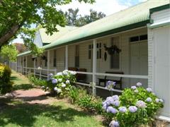
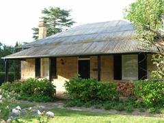
Old Bakery Cottage, Berrima
Image © David Powell, 2007
Last stop on this holiday was Berrima. An old 'museum' town, full of old buildings and boutique art & craft shops. One would be forgiven for thinking that's all there was, but the district also has
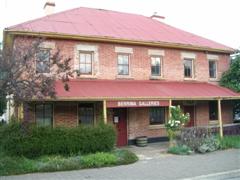
Berrima Galleries (Crown Inn, 1840s), Berrima
Berrima Galleries (Crown Inn)
Image © David Powell, 2007
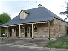
a lot of farms, a coal mine, one of the biggest cement plants in the state and a gaol. Of those, only the gaol shows any evidence in the town, 'cuz that's where it is. But even that is historic and blends in with the town scenery. This was only a teaser visit - a walk around to see what was there and to grab something to eat. We plan on spending several days in the region on a future trip. Founded in 1831, almost every building in the town is pre-1900 and the few that are 'new' are designed to blend in. In NSW at least, Berrima is the original "old town reborn as art and craft boutique shops", a model successfully followed by countless other country towns since then. A big part of its success was the bypassing of the town first by the railway line and then by the new freeway, both of which lead to the development of towns along the transport corridor as population centres and towns such as Berrima were relegated to the backwater and essentially left in a time warp. Population plummeted and there was no new development, which usually happens at the expense of the heritage. In the 1960's a heritage group was formed to work at preserving and restoring the heritage buildings and to preserve the town's mid 1800's feel. Their success is plainly evident today. And you can even go on guided tours riding a horse and carriage.
Breens Inn (1840), Berrima
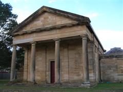
Courthouse (1838), Berrima
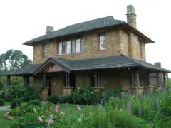
Governors' House, Gaol, Berrima
Breens Inn (1840), Berrima
Image © David Powell, 2007
Courthouse (1838), Berrima
Image © David Powell, 2007
Governors' House, Gaol, Berrima
Image © David Powell, 2007

Lots of lovely old buildings with nothing new-looking to disturb the harmony. Only a few pubs and cafés were open by the time we got there. Had a delicious dinner, complete with live music, at the Surveyor General Inn, built in 1834 and the oldest continually licensed pub in the
The First Bank (1836), Berrima
Image © David Powell, 2007
Gaol (1839), Berrima
Image © David Powell, 2007
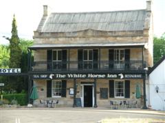
country. There was the quaint (such as the Cobb & Co Station) to the imposing (such as the gaol and court house). The town was established in the manner of an English village, around a village green. Markets were held there, attracting sellers from all over the district. The village green remains today and is one of the most striking features of the town, despite being bisected by the main road. It is full of lush and tall trees providing lots of shade, even on the hottest of days. The most notable planting is a giant oak tree, planted in 1890 by Sir Henry Parkes, the father of Australia. In addition to the village green, some of the more notable things include the court house, built 1835-1839. It was the site of Australia's first trial by jury in 1841. One of the more 'interesting' cases to pass thru' the court was that of John Lynch in 1842, a mass murderer. The most imposing building in the town is definitely the gaol, still in use and the oldest gaol in the country. Built at the same time as the court house, it's been extensively rebuilt over the years. The Surveyor General Inn is another central feature of the town. The oldest continually licensed inn in the state. It wasn't Berrima's first inn, tho' it's not the oldest inn in Berrima, that claim to fame lies with the Old Berrima Inn (1834), now a bakery and café. Closely followed by the Taylor's Crown Inn (1834), now home to the Berrima Galleries, and the Victoria Inn (1834), now a B&B. But the Surveyor General still plies the same trade it did back in the 1830's and is well worth a visit, if not for that trade then for the history, complete with bushranger boltholes - yes, bushrangers were a big problem in the 1800's, the most infamous was Ben Hall. And you never know who you'll see at the general - we bumped into a nationally famous but now retired TV personality. Then there're the many fine churches, the school, the First bank (1836), cottages and much more. The post office is relatively new (1886), one of the newest buildings surviving in the town.
The White Horse Inn (1840's), Berrima
Federation Oak Tree (1890), Berrima
Surveyor General Inn (1834), Berrima
The White Horse Inn (1840's), Berrima
Image © David Powell, 2007
Federation Oak Tree (1890), Berrima
Image © David Powell, 2007
Surveyor General Inn (1834), Berrima
Image © David Powell, 2007

Some web sites of relevance (valid as of January 2007)
Bombo Headland Quarry Geological Site: http://www.sydneywater.com.au/whoweare/OurHeritageAssets/_item_view.cfm?hi=4572730
Bombo Headlands: http://www.kiama.com.au/attractions/default.htm
Bombo Headland Landcare Group: http://www.landcareillawarra.org.au/bwWebsite/followon.asp?PageID=1800
Crooked River Wines: http://www.crookedriverwines.com/
Berry Courthouse, NSW Government State Heritage Listings: http://www.heritage.nsw.gov.au/07_subnav_02map.cfm
The Ill-Fated Cape St George Lighthouse: http://www.lighthouse.net.au/LIGHTS/NSW/Index%20NSW.htm
Depot Beach: http://www.clydecoast.com.au/depotbeach/index.html
Historic Mogo: http://www.southcoast.com.au/mogo/
Old Mogo Town Gold Rush Theme Park: http://www.oldmogotown.com.au/
South Coast - Broulee: http://www.visitnsw.com.au/Destination.aspx?DProductID=9001683
Walkabout - Broulee: http://walkabout.com.au/locations/NSWBroulee.shtml
Tomakin (Burrawarra Point): http://mysite.verizon.net/~brenin/tomakin.html
Batemans Bay, Wikipedia Entry: http://en.wikipedia.org/wiki/Batemans_Bay,_New_South_Wales
Bateman's Bay: http://www.southcoast.com.au/batemansbay/
Eurobodalla - Bateman's Bay: http://www.naturecoast-tourism.com.au/batemans.htm
Treasures From the Deep: http://www.wickedweekends.com.au/areas/nsw/south_coast/batemans_bay/opal/shell_museum.htm
Nelligen: http://www.nelligen.com/
Nelligen on the Clyde: http://www.southcoast.com.au/nelligen/index.html
Ulladulla: http://www.ulladulla.info/
Warden Head Lighthouse: http://www.lighthouse.net.au/liGhTS/NSW/Warden%20Head/Warden%20Head.htm
Ulladulla Lighthouse: http://www.ulladulla.info/attractions/lighthouse.html
Southern Highlands of NSW - Berrima: http://www.highlandsnsw.com.au/towns/berrima.html
Walkabout - Berrima: http://walkabout.com.au/locations/NSWBerrima.shtml
Historic Berrima: http://berrimavillage.com.au/index.html
Berrima Courthouse: http://www.berrimacourthouse.org.au/